

Welcome to Ground Truth, OmniGeo’s publication on the intersection of geospatial AI and physical risk, for the people building in Earth observation and the underwriters, asset owners, and risk teams who have to trust them.
On December 30, 2021, a grass fire ignited near the Marshall Mesa trailhead between Boulder and Superior, Colorado. Within hours, driven by hurricane-force winds and exceptionally dry conditions, it became the most destructive wildfire in Colorado history. More than 1,000 homes were destroyed. Entire neighborhoods disappeared in a single afternoon. One of those homes belonged to Scott Brave, my long-time colleague and friend, and our Co-Founder & Chief AI Officer.
The fire ultimately stopped roughly a mile and a half from our house. Close enough that we packed our car and left without knowing whether we would have a home to return to.
The Marshall Fire wasn’t Paradise, California. It wasn’t a remote mountain town surrounded by dense forest. It tore through suburban neighborhoods, business parks, schools, and shopping centers. Yet more than a thousand homes burned.
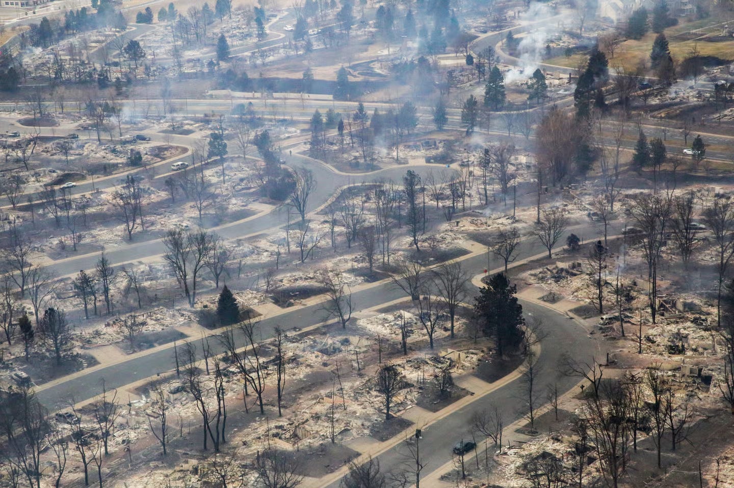
The event quickly became a case study in what fire scientists call urban conflagration: an increasingly important phenomenon where extreme weather, drought, vegetation, building materials, and structure-to-structure ignition combine into a cascading disaster. Areas not perceived as high-risk wildfire zones suddenly became the center of one of the country’s costliest disasters.
We have built some of the most sophisticated models to understand climate risk. We can simulate hurricane tracks, estimate flood probabilities, and project wildfire behavior. As I looked at the charred landscape by my home, I started to wonder: how could this happen? How did we miss this?
A search for answers
This was not a new field of study for me. Through my prior work with NatureX and the Nature Tech Collective, I had spent years studying physical risk, including wildfire, drought, biodiversity loss, insurance markets, and resilience, in conversations with insurers, reinsurers, catastrophe modelers, investors, regulators, and scientists. After enough of these discussions, a pattern had emerged.
While everyone was focused on modeling the future, there was a bigger, more urgent gap that linked back to how an event like the Marshall Fire could occur. This gap was illustrated by the questions I heard come up again and again. An insurer wanted to know whether a property had become more vulnerable to wildfire since its last inspection. A lender wanted to understand the physical exposure of a mortgage portfolio. A utility wanted to know where vegetation was creating operational risk. A conservation organization wanted to understand whether an ecosystem was improving or deteriorating.
The missing information was remarkably similar. Therein lies the problem: we have difficulty measuring the current condition of the world with our existing tools. And the models that we rely on often miss these critical details. I started to understand that models are only as good as their input data.
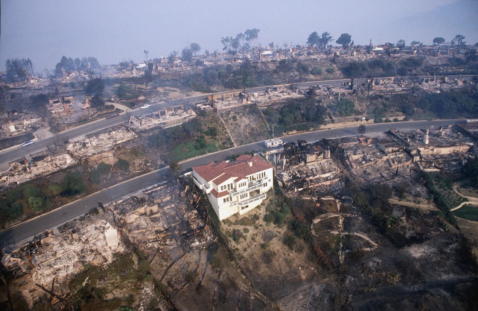
Property risk is generally described as a combination of hazard, exposure, and vulnerability. Of the three, vulnerability has received far less attention because it is far harder to observe: What is the roof made of? How much combustible vegetation surrounds the structure? Has mitigation occurred? How has the property changed since the last inspection? What physical characteristics make one home survive while another burns?
Those questions sound deceptively simple. But answering them across millions of properties has historically been expensive, slow, and often impossible.
A breakthrough appears
Around this time, Scott and I were introduced to Dr. Ophir Almog. Ophir had spent decades in remote sensing and Earth observation, including serving as Chief Science Officer of Israel’s elite Unit 9900 before earning a PhD in Remote Sensing from the Technion. He approached imagery from a fundamentally different perspective.
Most people look at a satellite image and see objects: a building, a road, a forest. Modern computer vision systems largely do the same, recognizing patterns and assigning labels. Ophir’s work started from a different question. Not, “what is it?” But “what is it made of?”
For decades, answering that question required hyperspectral sensors capable of measuring hundreds of wavelengths beyond human vision. These systems can reveal material composition, moisture content, vegetation health, and physical condition invisible in conventional imagery. They are also expensive, uncommon, and often tied to defense and intelligence applications.
The industry assumption was straightforward: if you don’t have hyperspectral imagery, you don’t get hyperspectral insights. Ophir spent years challenging that assumption. His work focused on spectral super-resolution, the reconstruction of hidden spectral information from ordinary imagery. In simple terms, recovering physical signals from data most people considered insufficient.
When we first encountered the work, we weren’t thinking about starting a company, only whether there might be a fundamentally better way to measure the physical world. The more we learned, the clearer it became that the real bottleneck wasn’t access to imagery. Commercial satellites already collect petabytes of Earth observation data every year.
The bottleneck is the ground truth. The condition and material intelligence that answer the questions posed across so many of my conversations. We have become very good at collecting pictures of the world. We remain surprisingly poor at understanding the physical reality behind those pictures.
That realization arrived as artificial intelligence was advancing at extraordinary speed. AI models could write, reason, code, and generate content, yet remained surprisingly limited in understanding the physical world. They could describe wildfire risk. But they could not reliably tell you whether a roof was asphalt or concrete tile, or whether mitigation had materially changed a property’s vulnerability.
Insurance is simply where the consequences are easiest to see. Premiums rise. Carriers exit markets. Communities become harder to insure. Capital retreats from uncertainty. But the same challenge exists across infrastructure, agriculture, energy, supply chains, environmental monitoring, and eventually what many are now calling physical AI.
Wildfire became our starting point because it sits at the intersection of these forces and we had been impacted by it firsthand. The losses are happening, the stakes are immediate, and regulators in California and Colorado are already pushing the industry toward more granular, property-level understanding of risk and mitigation.
We started this journey thinking we were studying climate risk. We eventually realized we were studying an intelligence problem. That’s why we started OmniGeo: to help insurance and finance underwrite, price, and monitor physical risk at the individual asset level.
Where we are today
For the past two years, we’ve been building largely out of sight, focused on a different question than the one dominating the AI conversation: how do you teach machines to measure the physical world? That work led us deep into spectral science, remote sensing, material intelligence, and what we believe is an entirely new category of geospatial reasoning technology - years spent validating the science, building the platform, and testing it with early partners.
Today, OmniGeo is coming out of stealth. We’re launching our first product with a few design partners, a property-level, wildfire risk API for P&C underwriters, risk providers and wildfire modelers called OmniFire.
The product converts satellite, aerial, and drone imagery into dynamic, physics-based property risk signals that help insurers price, underwrite and monitor wildfire risk at the parcel level. Rather than relying solely on static inspections or coarse regional models, carriers can continuously measure the physical characteristics that influence vulnerability, including building materials, defensible space, vegetation condition, fuel density, and property-level change over time.
We chose property wildfire risk as our first market because the need is immediate and the economic impact is measurable. Better measurement creates better underwriting, stronger incentives for mitigation, and ultimately more resilient communities. We are currently in beta with a small group of carriers and risk providers with portfolio exposure across California and Colorado.
The measurement layer behind Ground Truth
OmniGeo’s first product, OmniFire, closes the earth measurement gap for insurers in wildfire-prone areas. OmniFire turns standard imagery into parcel level measurements of what a property is actually made of, including roof material, defensible space, and fuel moisture. It’s vulnerability measured at scale and it’s live today. If you underwrite, price, or manage wildfire risk, visit www.omnigeo.ai/omnifire to learn more.